News
Nebraska Feedlot RNG Groundbreaking: Satellite Verification of Agricultural Energy Buildouts
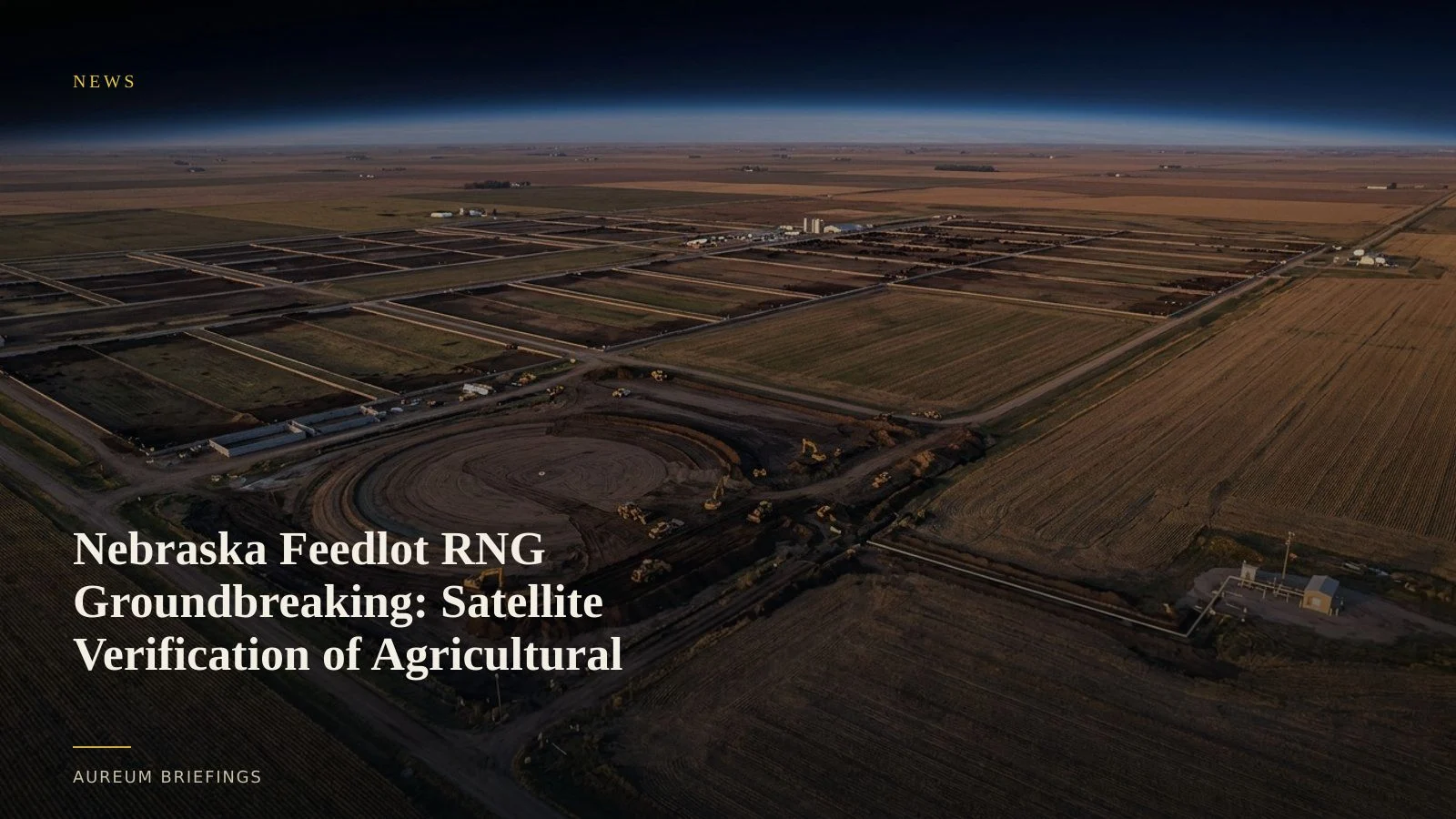
Eight anaerobic digesters in Broken Bow aim to deliver 1.2 million MMBtu of natural gas annually. Satellite observation reveals earth-moving and pipeline tying months before commercial flows start.
Agricultural waste expands domestic gas infrastructure
Groundbreaking has begun on a major agricultural energy facility in Broken Bow, Nebraska, designed to process livestock manure into 1.2 million MMBtu of pipeline-quality renewable natural gas per year. Project developers at the Adams Land & Cattle feedlot are installing eight large anaerobic digesters to supply commercial energy networks.
This development marks a continued push to integrate distributed agricultural supply into regional pipeline systems. As detailed in recent coverage of the renewable natural gas project in Nebraska, converting cattle waste into merchantable gas provides a dual revenue stream for agricultural operators while supplementing regional gas supplies.
For commodity traders and energy markets, distributed biogas facilities present a distinct tracking challenge. Individual site announcements rarely offer verified construction timelines, leaving physical capacity additions uncertain until pipeline interconnects open.
Tracking digester footprint and pipeline tie-ins
Verifying whether an agricultural gas facility is on schedule requires observing physical ground clearing, containment vessel assembly, and pipeline trenching. Institutional research platforms often reserve ground-level site tracking for enterprise clients, whereas DIY traders usually rely on static map layers that fail to reflect weekly progress.
Through European satellite observation networks, optical sensors capture concrete slab pouring, containment dome inflation, and earthmoving activity across rural acreage. Observing these structural markers provides independent proof of capital deployment long before facility commissioning.
Similar spatial verification methods apply across broader infrastructure recovery and asset monitoring, as seen in institutional analyses of critical infrastructure resilience frameworks. Ground truth verification eliminates reliance on corporate press releases.
Bridging the announcement lag before pipeline prints
When new biogas projects go online, their output eventually reflects in regional storage balance prints and official natural gas supply benchmarks. However, official reporting aggregates regional volumes, obscuring specific facility startup dates.
By measuring ground disturbance, retention pond construction, and gas compression housing assembly, traders can estimate when a facility transitions from site work to active gas production. This spatial evidence helps market participants anticipate localised grid injections.
Rather than waiting for quarterly corporate updates or retrospective pipeline flow reports, direct satellite monitoring provides an objective view of physical infrastructure progress.
Integrating satellite evidence into trading workflows
Monitoring physical infrastructure requires a structured process: identifying ground-truth coordinates, comparing historical imagery baselines, and identifying structural changes over time.
Query simplifies this decision pathway by answering specific location questions with clear satellite evidence, eliminating the need to process raw raster files or manage complex software stacks.
Track complements this by offering hand-built KPI boards across major industrial corridors, allowing users to follow established energy and logistics assets seamlessly.
Track physical commodity assets from space
Join the Aureum private beta to query physical infrastructure developments and follow curated energy and commodity boards.