News
Perim Island Bab el-Mandeb Occupation: Satellite Verification
Reports confirm Houthi forces have reached strategic Perim Island at the narrowest threshold of the Bab el-Mandeb Strait. Satellite radar imagery provides physical verification of shifting vessel transit corridors and chokepoint activity.
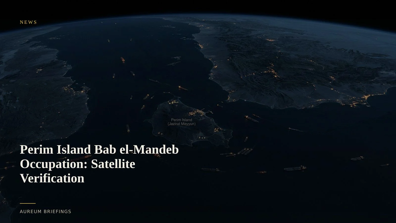
Houthi forces reach strategic volcanic island at Red Sea entry
According to vessel transit reports on gCaptain, Yemeni government sources confirmed that Iran-aligned Houthi forces have established a presence on Perim Island, also known as Mayun. The volcanic island sits directly inside the narrowest stretch of the Bab el-Mandeb Strait.
This geographical positioning puts physical surface optics and anti-ship missile vantage points directly over primary commercial transit lanes.
For energy and container shipping markets, control over Perim Island signals a major escalation in physical trade security, directly affecting tanker freight benchmarks and maritime insurance risk premiums.
Why Perim Island dictates Red Sea physical trade flows
The Bab el-Mandeb Strait is only twenty kilometres wide at its narrowest point. Perim Island splits this bottleneck into the Large Strait to the west and the Small Strait to the east.
When ground forces occupy the island, visual and radar targeting systems can cover the entirety of both shipping passages without relying on coastal mainland stations.
As a result, commercial fleets trading between Europe, Asia, and the Persian Gulf face immediate choices: queue at southern Red Sea anchorages, attempt high-risk dark transits, or divert around the Cape of Good Hope.
Synthetic aperture radar verifies vessel diversions and dark transits
When geopolitical risks spike, ship operators frequently disable Automatic Identification System (AIS) transponders to mask movement. Optical satellites can also be obstructed by regional dust storms.
To overcome these blind spots, ESA Copernicus Sentinel-1 SAR imagery pierces cloud cover and dust layers to detect metallic hull signatures on water.
Satellite radar allows analysts to quantify vessel counts, transits, and queue density through the Bab el-Mandeb regardless of AIS status. Institutional research teams often buy high-resolution commercial feeds from vendors like ICEYE, but retail traders can track broader traffic trends using curated satellite intelligence.
Translating physical chokepoint data into market decisions
Changes in Bab el-Mandeb transit volumes feed directly into global shipping benchmarks, including the Baltic Exchange dry bulk and tanker indices. When transit density through the strait drops, long-haul tonne-mile demand increases sharply as vessels reroute around Africa.
Instead of waiting for delayed monthly port throughput reports, traders look at satellite-backed vessel counts across key anchorages and strait channels to gauge real-world supply disruption.
Aureum delivers this visibility directly to traders through structured hand-built KPI boards and plain-English satellite query capabilities.
Monitor global physical chokepoints with satellite intelligence
Aureum provides satellite-backed verification for physical trade routes and infrastructure. Follow curated boards on named corridors or ask specific questions with Query.